100 Sights in New York, United States (with Map and Images)
Legend
Welcome to your journey through the most beautiful sights in New York, United States! Whether you want to discover the city's historical treasures or experience its modern highlights, you'll find everything your heart desires here. Be inspired by our selection and plan your unforgettable adventure in New York. Dive into the diversity of this fascinating city and discover everything it has to offer.
Sightseeing Tours in New York1. One World Trade Center
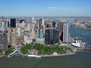
One World Trade Center, also known as One WTC and Freedom Tower, is the main building of the rebuilt World Trade Center complex in Lower Manhattan, New York City. Designed by David Childs of Skidmore, Owings & Merrill, One World Trade Center is the tallest building in the United States, the tallest building in the Western Hemisphere, and the seventh-tallest in the world. The supertall structure has the same name as the North Tower of the original World Trade Center, which was destroyed in the terrorist attacks of September 11, 2001. The new skyscraper stands on the northwest corner of the 16-acre (6.5 ha) World Trade Center site, on the site of the original 6 World Trade Center. It is bounded by West Street to the west, Vesey Street to the north, Fulton Street to the south, and Washington Street to the east.
2. Madison Square Garden
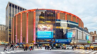
Madison Square Garden, colloquially known as the Garden or by its initials MSG, is a multi-purpose indoor arena in New York City. It is located in Midtown Manhattan between Seventh and Eighth avenues from 31st to 33rd streets above Pennsylvania Station. It is the fourth venue to bear the name "Madison Square Garden"; the first two, opened in 1879 and 1890 respectively, were located on Madison Square, on East 26th Street and Madison Avenue, with the third Madison Square Garden (1925) farther uptown at Eighth Avenue and 50th Street.
3. Hare Krishna Temple

International Society for Krishna Consciousness (ISKCON), commonly referred to as the Hare Krishna movement, Gaudiya Vaishnava Hindu religious organization. It was founded by A. C. Bhaktivedanta Swami Prabhupada. on July 13, 1966, in New York City. ISKCON's main headquarters is in Mayapur, West Bengal, India and it claims approximately 1 million members globally.
Wikipedia: International Society for Krishna Consciousness (EN), Website
4. Central Park
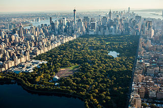
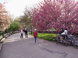
Central Park is an urban park between the Upper West Side and Upper East Side neighborhoods of Manhattan in New York City that was the first landscaped park in the United States. It is the sixth-largest park in the city, containing 843 acres (341 ha), and the most visited urban park in the United States, with an estimated 42 million visitors annually as of 2016. It is also one of the most filmed locations in the world.
Wikipedia: Central Park (EN), Website, Twitter, Tiktok, Facebook, Instagram, Heritage Website, Pinterest, Youtube
5. Grand Central Terminal
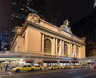
Grand Central Terminal is a commuter rail terminal located at 42nd Street and Park Avenue in Midtown Manhattan, New York City. Grand Central is the southern terminus of the Metro-North Railroad's Harlem, Hudson and New Haven Lines, serving the northern parts of the New York metropolitan area. It also contains a connection to the Long Island Rail Road through the Grand Central Madison station, a 16-acre (65,000 m2) rail terminal underneath the Metro-North station, built from 2007 to 2023. The terminal also connects to the New York City Subway at Grand Central–42nd Street station. The terminal is the third-busiest train station in North America, after New York Penn Station and Toronto Union Station.
6. The Met Cloisters
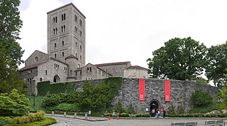
The Cloisters, also known as the Met Cloisters, is a museum in the Washington Heights neighborhood of Upper Manhattan, New York City. The museum, situated in Fort Tryon Park, specializes in European medieval art and architecture, with a focus on the Romanesque and Gothic periods. Governed by the Metropolitan Museum of Art, it contains a large collection of medieval artworks shown in the architectural settings of French monasteries and abbeys. Its buildings are centered around four cloisters—the Cuxa, Saint-Guilhem, Bonnefont and Trie—that were acquired by American sculptor and art dealer George Grey Barnard in France before 1913, and moved to New York. Barnard's collection was bought for the museum by financier and philanthropist John D. Rockefeller Jr. Other major sources of objects were the collections of J. P. Morgan and Joseph Brummer.
7. Studio 54
Studio 54 is a Broadway theater and former nightclub at 254 West 54th Street in Midtown Manhattan, New York City. Opened as the Gallo Opera House in 1927, it served as a CBS broadcast studio in the mid-20th century. Steve Rubell and Ian Schrager opened the Studio 54 nightclub, retaining much of the former theatrical and broadcasting fixtures, inside the venue in 1977. Roundabout Theatre Company renovated the space into a Broadway house in 1998.
8. American Museum of Natural History
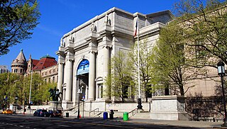
The American Museum of Natural History (AMNH) is a natural history museum on the Upper West Side of Manhattan in New York City. Located in Theodore Roosevelt Park, across the street from Central Park, the museum complex comprises 21 interconnected buildings housing 45 permanent exhibition halls, in addition to a planetarium and a library. The museum collections contain about 32 million specimens of plants, animals, fungi, fossils, minerals, rocks, meteorites, human remains, and human cultural artifacts, as well as specialized collections for frozen tissue and genomic and astrophysical data, of which only a small fraction can be displayed at any given time. The museum occupies more than 2,500,000 sq ft (232,258 m2). AMNH has a full-time scientific staff of 225, sponsors over 120 special field expeditions each year, and averages about five million visits annually.
9. Greenwich Village
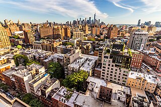
Greenwich Village, or simply the Village, is a neighborhood on the west side of Lower Manhattan in New York City, bounded by 14th Street to the north, Broadway to the east, Houston Street to the south, and the Hudson River to the west. Greenwich Village also contains several subsections, including the West Village west of Seventh Avenue and the Meatpacking District in the northwest corner of Greenwich Village.
10. National September 11 Memorial & Museum
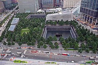
The National September 11 Memorial & Museum is a memorial and museum that are part of the World Trade Center complex, in New York City, created for remembering the September 11, 2001, attacks, which killed 2,977 people, and the 1993 World Trade Center bombing, which killed six. The memorial is located at the World Trade Center site, the former location of the Twin Towers that were destroyed during the September 11 attacks. It is operated by a non-profit institution whose mission is to raise funds to program and operate the memorial and museum at the World Trade Center site.
Wikipedia: National September 11 Memorial & Museum (EN), Website
11. United Nations Headquarters
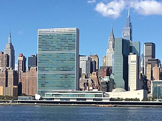
The headquarters of the United Nations (UN) is on 17 to 18 acres of grounds in the Turtle Bay neighborhood of Midtown Manhattan in New York City. It borders First Avenue to the west, 42nd Street to the south, 48th Street to the north, and the East River to the east. Completed in 1952, the complex consists of several structures, including the Secretariat, Conference, and General Assembly buildings, and the Dag Hammarskjöld Library. The complex was designed by a board of architects led by Wallace Harrison and built by the architectural firm Harrison & Abramovitz, with final projects developed by Oscar Niemeyer and Le Corbusier. The term Turtle Bay is occasionally used as a metonym for the UN headquarters or for the United Nations as a whole.
12. Rockefeller Center
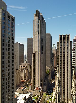
Rockefeller Center is a complex of 19 commercial buildings covering 22 acres (89,000 m2) between 48th Street and 51st Street in the Midtown Manhattan neighborhood of New York City. The 14 original Art Deco buildings, commissioned by the Rockefeller family, span the area between Fifth Avenue and Sixth Avenue, split by a large sunken square and a private street called Rockefeller Plaza. Later additions include 75 Rockefeller Plaza across 51st Street at the north end of Rockefeller Plaza, and four International Style buildings on the west side of Sixth Avenue.
13. MoMA
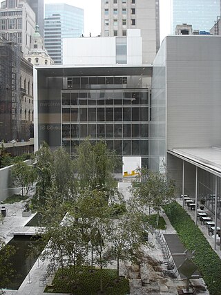
The Museum of Modern Art (MoMA) is an art museum located in Midtown Manhattan, New York City, on 53rd Street between Fifth and Sixth Avenues. The institution was conceived in 1929 by Abby Aldrich Rockefeller, Lillie P. Bliss, and Mary Quinn Sullivan. Initially located in the Heckscher Building on Fifth Avenue, it opened just days after the Wall Street Crash. The museum, America's first devoted exclusively to modern art, was led by A. Conger Goodyear as president and Abby Rockefeller as treasurer, with Alfred H. Barr Jr. as its first director. Under Barr's leadership, the museum's collection rapidly expanded, beginning with an inaugural exhibition of works by European modernists. Despite financial challenges, including opposition from John D. Rockefeller Jr., the museum moved to several temporary locations in its early years, and John D. Rockefeller Jr. eventually donated the land for its permanent site.
14. Guggenheim Museum
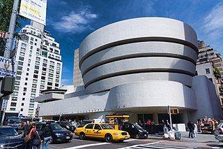
The Solomon R. Guggenheim Museum, often referred to as The Guggenheim, is an art museum at 1071 Fifth Avenue between 88th and 89th Streets on the Upper East Side of Manhattan in New York City. It hosts a permanent collection of Impressionist, Post-Impressionist, early Modern, and contemporary art and also features special exhibitions throughout the year. It was established by the Solomon R. Guggenheim Foundation in 1939 as the Museum of Non-Objective Painting, under the guidance of its first director, Hilla von Rebay. The museum adopted its current name in 1952, three years after the death of its founder Solomon R. Guggenheim. It continues to be operated and owned by the Solomon R. Guggenheim Foundation.
15. Saint Patrick’s Cathedral
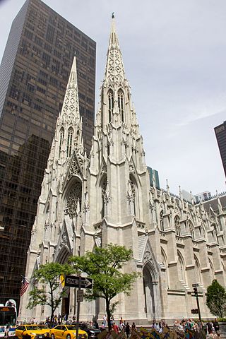
St. Patrick's Cathedral is a Catholic cathedral in the Midtown Manhattan neighborhood of New York City. It is the seat of the Archbishop of New York as well as a parish church. The cathedral occupies a city block bounded by Fifth Avenue, Madison Avenue, 50th Street, and 51st Street, directly across from Rockefeller Center. Designed by James Renwick Jr., it is the largest Gothic Revival Catholic cathedral in North America.
Wikipedia: St. Patrick's Cathedral (Midtown Manhattan) (EN), Website
16. SoHo
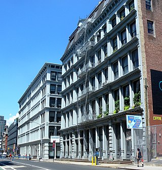
SoHo, short for "South of Houston Street", is a neighborhood in Lower Manhattan, New York City. Since the 1970s, the neighborhood has been the location of many artists' lofts and art galleries, and has also been known for its variety of shops ranging from trendy upscale boutiques to national and international chain store locations. The area's history is an archetypal example of inner-city regeneration and gentrification, encompassing socioeconomic, cultural, political, and architectural developments.
17. Apollo Theater
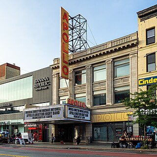
The Apollo Theater is a multi-use theater at 253 West 125th Street in the Harlem neighborhood of Upper Manhattan in New York City. It is a popular venue for black American performers and is the home of the TV show Showtime at the Apollo. The theater, which has approximately 1,500 seats across three levels, was designed by George Keister with elements of the neoclassical style. The facade and interior of the theater are New York City designated landmarks and are listed on the National Register of Historic Places. The nonprofit Apollo Theater Foundation (ATF) operates the theater, as well as two smaller auditoriums at the Victoria Theater and a recording studio at the Apollo.
18. Slocum Disaster Memorial
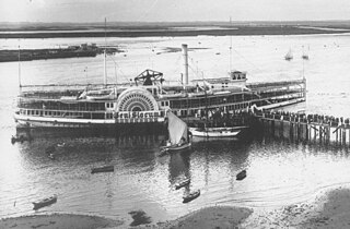
The PS General Slocum was an American sidewheel passenger steamboat built in Brooklyn, New York, in 1891. During her service history, she was involved in a number of mishaps, including multiple groundings and collisions.
19. Madison Square Park
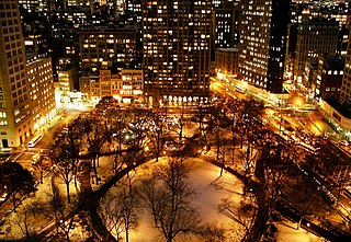
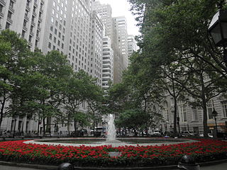
Madison Square is a public square formed by the intersection of Fifth Avenue and Broadway at 23rd Street in the New York City borough of Manhattan. The square was named for Founding Father James Madison, fourth President of the United States. The focus of the square is Madison Square Park, a 6.2-acre (2.5-hectare) public park, which is bounded on the east by Madison Avenue ; on the south by 23rd Street; on the north by 26th Street; and on the west by Fifth Avenue and Broadway as they cross.
Wikipedia: Madison Square and Madison Square Park (EN), Website
20. General Grant National Memorial
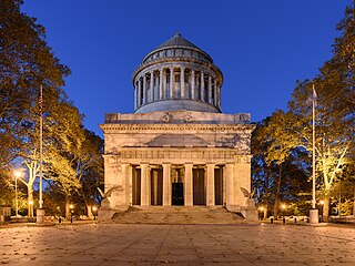
Grant's Tomb, officially the General Grant National Memorial, is the final resting place of Ulysses S. Grant, the 18th president of the United States, and of his wife Julia. It is a classical domed mausoleum in the Morningside Heights neighborhood of Upper Manhattan in New York City, New York, United States. The structure is in the middle of Riverside Drive at 122nd Street, adjacent to Riverside Park. In addition to being a national memorial since 1958, Grant's Tomb is listed on the National Register of Historic Places, and its facade and interior are New York City designated landmarks.
21. Charging Bull
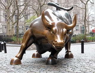
Charging Bull is a bronze sculpture that stands on Broadway just north of Bowling Green in the Financial District of Manhattan in New York City. The 7,100-pound (3,200 kg) bronze sculpture, standing 11 feet (3.4 m) tall and measuring 16 feet (4.9 m) long, depicts a bull, the symbol of financial optimism and prosperity. Charging Bull is a popular tourist destination that draws thousands of people a day, symbolizing Wall Street and the Financial District.
22. Washington Square Park
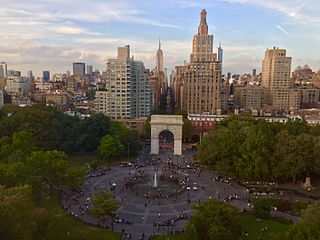
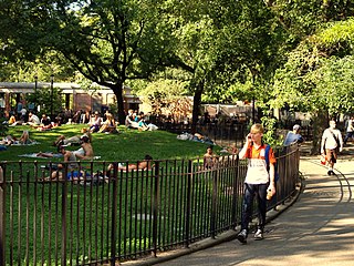
Washington Square Park is a 9.75-acre (3.95 ha) public park in the Greenwich Village neighborhood of Lower Manhattan, New York City. It is an icon as well as a meeting place and center for cultural activity. The park is operated by the New York City Department of Parks and Recreation.
23. Bryant Park
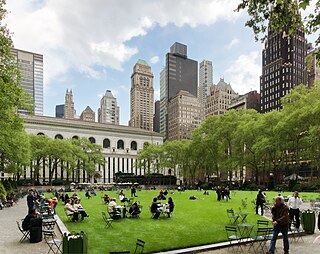
Bryant Park is a 9.6-acre (3.9 ha), privately managed public park in the New York City borough of Manhattan. It is located between Fifth Avenue and Avenue of the Americas and between 40th and 42nd Streets in Midtown Manhattan. The eastern half of Bryant Park is occupied by the Main Branch of the New York Public Library. The western half contains a lawn, shaded walkways, and amenities such as a carousel, and is located entirely over an underground structure that houses the library's stacks. The park hosts several events, including a seasonal "Winter Village" with an ice rink and shops during the winter.
24. USS Intrepid
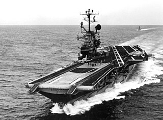
USS Intrepid (CV/CVA/CVS-11), also known as The Fighting "I", is one of 24 Essex-class aircraft carriers built during World War II for the United States Navy. She is the fourth US Navy ship to bear the name. Commissioned in August 1943, Intrepid participated in several campaigns in the Pacific Theater of Operations, including the Battle of Leyte Gulf.
25. Seagram Building
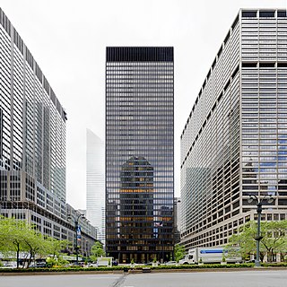
The Seagram Building is a skyscraper at 375 Park Avenue, between 52nd and 53rd Streets, in the Midtown Manhattan neighborhood of New York City. Designed by Ludwig Mies van der Rohe along with Philip Johnson, Ely Jacques Kahn, and Robert Allan Jacobs, the high-rise tower is 515 feet (157 m) tall with 38 stories. The International Style building, completed in 1958, initially served as the headquarters of the Seagram Company, a Canadian distiller.
26. Battery Park
The Battery, formerly known as Battery Park, is a 25-acre (10 ha) public park located at the southern tip of Manhattan Island in New York City facing New York Harbor. It is bounded by Battery Place on the north, with Bowling Green to the northeast, State Street on the east, New York Harbor to the south, and the Hudson River to the west. The park contains attractions such as an early 19th-century fort named Castle Clinton; multiple monuments; and the SeaGlass Carousel. The surrounding area, known as South Ferry, contains multiple ferry terminals, including the Staten Island Ferry's Whitehall Terminal; a boat launch to the Statue of Liberty National Monument ; and a boat launch to Governors Island.
27. Lincoln Center for the Performing Arts
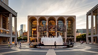
Lincoln Center for the Performing Arts is a 16.3-acre (6.6-hectare) complex of buildings in the Lincoln Square neighborhood on the Upper West Side of Manhattan. It has thirty indoor and outdoor facilities and is host to 5 million visitors annually. It houses internationally renowned performing arts organizations including the New York Philharmonic, the Metropolitan Opera, the New York City Ballet, the Chamber Music Society of Lincoln Center and the Juilliard School.
28. Whitney Museum of American Art
The Whitney Museum of American Art, known informally as "The Whitney", is a modern and contemporary American art museum located in the Meatpacking District and West Village neighborhoods of Manhattan in New York City. The institution was originally founded in 1930 by Gertrude Vanderbilt Whitney (1875–1942), a prominent American socialite, sculptor, and art patron after whom it is named.
29. Parachute Jump
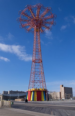
The Parachute Jump is a defunct amusement ride and a landmark in the New York City borough of Brooklyn, along the Riegelmann Boardwalk at Coney Island. Situated in Steeplechase Plaza near the B&B Carousell, the structure consists of a 250-foot-tall (76 m), 170-short-ton (150 t) open-frame, steel parachute tower. Twelve cantilever steel arms radiate from the top of the tower; when the ride was in operation, each arm supported a parachute attached to a lift rope and a set of guide cables. Riders were belted into a two-person canvas seat, lifted to the top, and dropped. The parachute and shock absorbers at the bottom would slow their descent.
30. Brooklyn Museum
The Brooklyn Museum is an art museum in the New York City borough of Brooklyn. At 560,000 square feet (52,000 m2), the museum is New York City's second largest and contains an art collection with around 500,000 objects. Located near the Prospect Heights, Crown Heights, Flatbush, and Park Slope neighborhoods of Brooklyn, the museum's Beaux-Arts building was designed by McKim, Mead & White.
31. Coney Island Cyclone
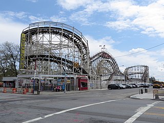
The Cyclone, also called the Coney Island Cyclone, is a wooden roller coaster at Luna Park in the Coney Island neighborhood of Brooklyn in New York City. Designed by Vernon Keenan, it opened to the public on June 26, 1927. The roller coaster is on a plot of land at the intersection of Surf Avenue and West 10th Street. The Cyclone reaches a maximum speed of 60 miles per hour (97 km/h) and has a total track length of 2,640 feet (800 m), with a maximum height of 85 feet (26 m).
32. Riverside Park
Riverside Park is a scenic public park on the waterfront of the Upper West Side, Morningside Heights, and Hamilton Heights neighborhoods of the borough of Manhattan in New York City. The park measures 4 miles (6.4 km) long and 100 to 500 feet wide, running between the Hudson River and Henry Hudson Parkway to the west and the serpentine Riverside Drive to the east.
33. Unisphere
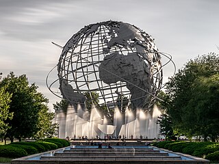
The Unisphere is a spherical stainless steel representation of the Earth at Flushing Meadows–Corona Park in Queens, New York City, United States. The globe was designed by Gilmore D. Clarke for the 1964 New York World's Fair. Commissioned to celebrate the beginning of the space age, the Unisphere was conceived and constructed as the theme symbol of the World's Fair. The theme of the World's Fair was "Peace Through Understanding", and the Unisphere represented the theme of global interdependence, being dedicated to "Man's Achievements on a Shrinking Globe in an Expanding Universe".
34. Stonewall Inn
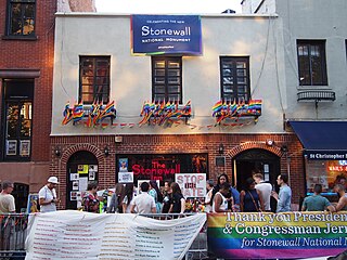
The Stonewall Inn is a gay bar and recreational tavern at 53 Christopher Street in the Greenwich Village neighborhood of Manhattan in New York City. It was the site of the 1969 Stonewall riots, which led to the gay liberation movement and the modern fight for LGBT rights in the United States. When the riots occurred, Stonewall was one of the relatively few gay bars in New York City. The original gay bar occupied two structures at 51–53 Christopher Street, which were built as horse stables in the 1840s.
35. Palace Theater
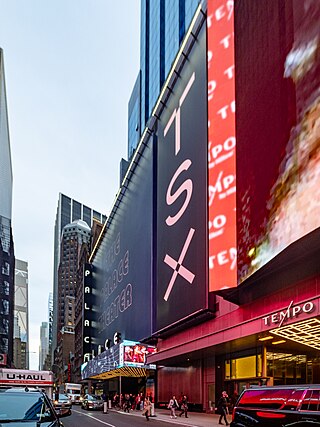
The Palace Theatre is a Broadway theater at 1564 Broadway, at the north end of Times Square, in the Midtown Manhattan neighborhood of New York City. Designed by Milwaukee architects Kirchhoff & Rose, the theater was funded by Martin Beck and opened in 1913. From its opening to about 1929, the Palace was considered among vaudeville performers as the flagship venue of Benjamin Franklin Keith and Edward Franklin Albee II's organization. The theater had 1,648 seats across three levels as of 2018.
36. Prison Ship Martyrs Monument
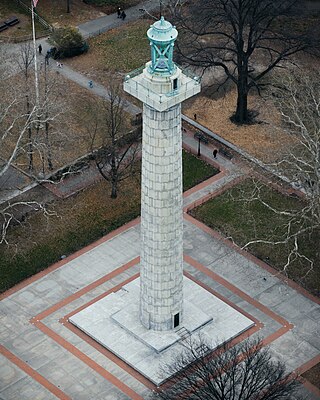
The Prison Ship Martyrs' Monument is a war memorial at Fort Greene Park, in the New York City borough of Brooklyn. It commemorates more than 11,500 American prisoners of war who died in captivity aboard sixteen British prison ships during the American Revolutionary War. The remains of a small fraction of those who died on the ships are interred in a crypt beneath its base. The sixteen ships included HMS Jersey, HMS Scorpion, Good Hope, Falmouth, Stromboli and Hunter.
37. Van Cortlandt Park
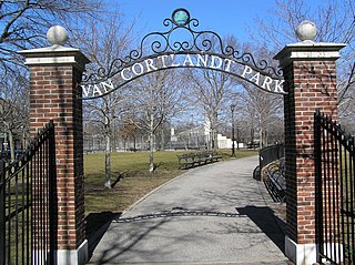
Van Cortlandt Park is a 1,146-acre (464 ha) park located in the borough of the Bronx in New York City. Owned by the New York City Department of Parks and Recreation, it is managed with assistance from the Van Cortlandt Park Alliance. The park, the city's third-largest, was named for the Van Cortlandt family, which was prominent in the area during the Dutch and English colonial periods.
38. Columbus Circle
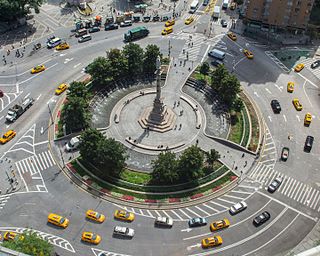
Columbus Circle is a traffic circle and heavily trafficked intersection in the New York City borough of Manhattan, located at the intersection of Eighth Avenue, Broadway, Central Park South, and Central Park West, at the southwest corner of Central Park. The circle is the point from which official highway distances from New York City are measured, as well as the center of the 25 miles (40 km) restricted-travel area for C-2 visa holders.
39. Frick Collection
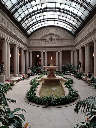
The Frick Collection is an art museum on the Upper East Side of Manhattan in New York City, New York, U.S. It was established in 1935 to preserve the art collection of the industrialist Henry Clay Frick. The collection consists of 14th- to 19th-century European paintings, as well as other pieces of European fine and decorative art. It is located at the Henry Clay Frick House, a Beaux-Arts mansion designed for Henry Clay Frick. The Frick also houses the Frick Art Research Library, an art history research center established by Frick's daughter Helen Clay Frick in 1920, which contains sales catalogs, books, periodicals, and photographs.
40. Federal Hall National Memorial
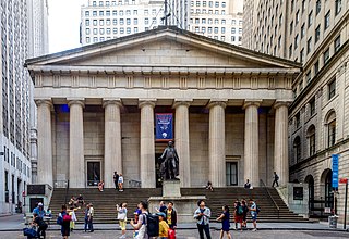
Federal Hall is a memorial and historic site at 26 Wall Street in the Financial District of Manhattan in New York City. The current Greek Revival–style building, completed in 1842 as the Custom House, is owned by the United States federal government and operated by the National Park Service as a national memorial called the Federal Hall National Memorial. The memorial is named for an earlier Federal style building on this same site, completed in 1703 as City Hall, which the government of the newly independent United States used as its capital building and called Federal Hall during the 1780s.
41. Met Life Tower
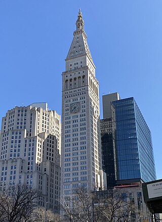
The Metropolitan Life Insurance Company Tower is a skyscraper occupying a full block in the Flatiron District of Manhattan in New York City. The building is composed of two sections: a 700-foot-tall (210 m) tower at the northwest corner of the block, at Madison Avenue and 24th Street, and a shorter east wing occupying the remainder of the block bounded by Madison Avenue, Park Avenue South, 23rd Street, and 24th Street. The South Building, along with the North Building directly across 24th Street, comprises the Metropolitan Home Office Complex, which originally served as the headquarters of the Metropolitan Life Insurance Company.
42. Intrepid Museum
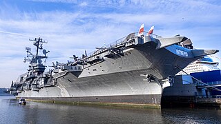
The Intrepid Museum is an American military and maritime history museum in New York City. It is located at Pier 86 at 46th Street, along the Hudson River, in the Hell's Kitchen neighborhood on the West Side of Manhattan. The museum is mostly composed of exhibits, aircraft, and spacecraft aboard the museum ship USS Intrepid, a World War II–era aircraft carrier, as well as a cruise missile submarine named USS Growler and exhibits on Pier 86. The Intrepid Museum Foundation, a 501(c)(3) organization established in 1979, operates the museum.
43. New Amsterdam Theatre
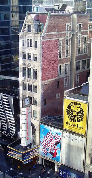
The New Amsterdam Theatre is a Broadway theater at 214 West 42nd Street, at the southern end of Times Square, in the Theater District of Manhattan in New York City. One of the first Broadway venues to open in the Times Square neighborhood, the New Amsterdam was built from 1902 to 1903 to designs by Herts & Tallant. The theater is operated by Disney Theatrical Productions and has 1,702 seats across three levels. Both the Beaux-Arts exterior and the Art Nouveau interior of the building are New York City landmarks, and the building is on the National Register of Historic Places.
44. South Street Seaport
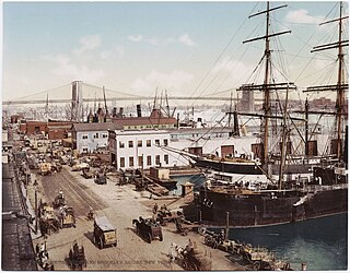
The South Street Seaport is a historic area in the New York City borough of Manhattan, centered where Fulton Street meets the East River, within the Financial District of Lower Manhattan. The Seaport is a designated historic district. It is part of Manhattan Community Board 1 in Lower Manhattan, and is next to the East River to the southeast and the Two Bridges neighborhood to the northeast.
45. Fortitude
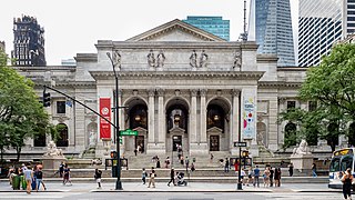
The Stephen A. Schwarzman Building is the flagship building in the New York Public Library system in the Midtown neighborhood of Manhattan in New York City. The branch, one of four research libraries in the library system, has nine divisions. Four stories of the structure are open to the public. The main entrance steps are at Fifth Avenue at its intersection with East 41st Street. As of 2015, the branch contains an estimated 2.5 million volumes in its stacks. The building was declared a National Historic Landmark, a National Register of Historic Places site, and a New York City designated landmark in the 1960s.
Wikipedia: New York Public Library Main Branch (EN), Website
46. The Morgan Library & Museum
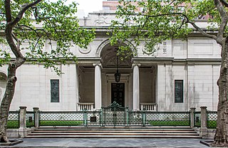
The Morgan Library & Museum is a museum and research library at 225 Madison Avenue in the Murray Hill neighborhood of Manhattan in New York City, New York, U.S. Completed in 1906 as the private library of the banker J. P. Morgan, the institution has more than 350,000 objects. As of 2024, the museum is directed by Colin B. Bailey and governed by a board of trustees.
47. Brooklyn Botanic Garden

Brooklyn Botanic Garden (BBG) is a botanical garden in the borough of Brooklyn in New York City. The botanical garden occupies 52 acres (21 ha) in central Brooklyn, close to Mount Prospect Park, Prospect Park, and the Brooklyn Museum. Designed by the Olmsted Brothers, BBG holds over 14,000 taxa of plants and has over 800,000 visitors each year. It includes a number of specialty gardens, plant collections, and structures. BBG hosts numerous educational programs, plant-science and conservation, and community horticulture initiatives, in addition to a herbarium collection.
48. Fearless Girl
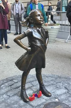
Fearless Girl is a bronze sculpture by Kristen Visbal of a 4-foot high (1.2 m) girl standing in a self-confident pose. It is currently located in New York City on Broad Street across from the New York Stock Exchange Building in the Financial District of Manhattan.
49. City Hall
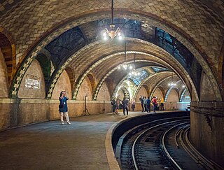
The City Hall station, also known as City Hall Loop station, is a closed station on the IRT Lexington Avenue Line of the New York City Subway. It is located under City Hall Park, next to New York City Hall, in the Civic Center neighborhood of Manhattan in New York City. The station was constructed for the Interborough Rapid Transit Company (IRT) as the southern terminal of the city's first subway line, which was approved in 1900. Construction of the segment of the line that includes the City Hall station started on September 12 of the same year. The station opened on October 27, 1904, as one of the original 28 stations of the New York City Subway. As ridership grew, it was deemed infeasible to lengthen the original platform to accommodate ten-car trains. The station was closed on December 31, 1945, because of its proximity to the Brooklyn Bridge station.
Wikipedia: City Hall station (IRT Lexington Avenue Line) (EN)
50. Westinghouse Time Capsules
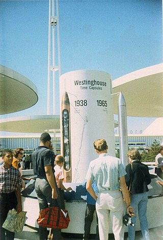
The Westinghouse Time Capsules are two time capsules prepared by the Westinghouse Electric & Manufacturing Company. One was made in 1939 and the other in 1965. They are filled with contemporary articles used in the twentieth century way of life in the United States. The items are intended for people of the 7th millennium to receive for historical significance.
51. Zuccotti Park
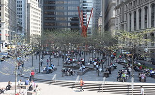
Zuccotti Park is a 33,000-square-foot (3,100 m2) publicly accessible park in the Financial District of Lower Manhattan in New York City. It is located in a privately owned public space (POPS) controlled by Brookfield Properties and Goldman Sachs. Zuccotti Park is bounded by Broadway to the east, Liberty Street to the north, Trinity Place to the west, and Cedar Street to the south.
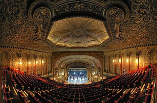
52. Beacon Theater
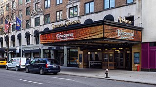
The Beacon Theatre is an entertainment venue at 2124 Broadway, adjacent to the Hotel Beacon, on the Upper West Side of Manhattan in New York City. Opened in 1929, the Beacon Theatre was developed by Samuel "Roxy" Rothafel and built as a movie palace, with 2,894 seats across three levels. It was designed by Walter W. Ahlschlager with decorations inspired by the Renaissance, Ancient Roman, Ancient Greek, and Rococo styles. The theater is designated as a New York City interior landmark and is listed on the National Register of Historic Places.
53. Koreatown
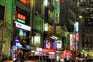
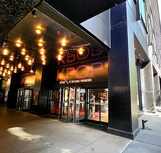
Koreatown, or K-Town, is an ethnic Korean enclave in Midtown Manhattan, New York City, centered on 32nd Street between Madison Avenue and the intersection with Sixth Avenue and Broadway, which is known as Greeley Square. The neighborhood in Midtown South features over 150 businesses of various types and sizes, ranging from small restaurants and beauty salons to large branches of Korean banking conglomerates. Koreatown, Manhattan, has become described as the "Korean Times Square" and has emerged as the international economic outpost for the Korean chaebol.
54. Morningside Park
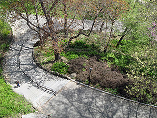
Morningside Park is a 30-acre (12-hectare) public park in Upper Manhattan, New York City, United States. The park is bounded by 110th Street to the south, 123rd Street to the north, Morningside Avenue to the east, and Morningside Drive to the west. A cliff made of Manhattan schist runs through the park and separates Morningside Heights, above the cliff to the west, from Harlem. The park includes other rock outcroppings; a human-made ornamental pond and waterfall; three sculptures; several athletic fields; playgrounds; and an arboretum. Morningside Park is operated by the New York City Department of Parks and Recreation, although the group Friends of Morningside Park helps maintain it.
55. Queens Museum
The Queens Museum is an art museum and educational center at Flushing Meadows–Corona Park in Queens, New York City, United States. Established in 1972, the museum has among its permanent exhibitions the Panorama of the City of New York, a room-sized scale model of the five boroughs originally built for the 1964 New York World's Fair. Its collection includes a large archive of artifacts from both the 1939 and 1964 World's Fairs, a selection of which is on display. As of 2018, Queens Museum's director is Sally Tallant.
56. Bowling Green
Bowling Green is a small, historic, public park in the Financial District of Lower Manhattan, New York City, at the southern end and address origin of Broadway. Located in the 18th century next to the site of the original Dutch fort of New Amsterdam, it served as a public gathering place and under the English was designated as a park in 1733. It is the oldest public park in New York City and is surrounded by its original 18th-century cast iron fence. The park included an actual bowling green and a monumental equestrian statue of King George III prior to the American Revolutionary War. Pulled down during the revolution, the 4000-pound statue is said to have been melted for ammunition to fight the British.
57. United Palace
The United Palace is a theater at 4140 Broadway in the Washington Heights neighborhood of Manhattan in New York City. The theater, occupying a full city block bounded by Broadway, Wadsworth Avenue, and West 175th and 176th Streets, functions both as a spiritual center and as a nonprofit cultural and performing arts center. The architect, Thomas W. Lamb, designed the theater as a movie palace, which opened on February 22, 1930, as one of five Loew's Wonder Theatres in the New York City area. The theater's interior decor, incorporating elements of numerous architectural styles, was supervised by Lamb and Harold Rambusch.
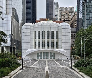
58. St. Nicholas Greek Orthodox Church
The St. Nicholas Greek Orthodox Church, officially the St. Nicholas Greek Orthodox Church and National Shrine, is a church and shrine in the World Trade Center in Lower Manhattan, New York City. It is administered by the Greek Orthodox Archdiocese of America and has been developed by the Port Authority of New York and New Jersey, based upon the design of Spanish architect Santiago Calatrava. The church was consecrated on July 4, 2022.
Wikipedia: St. Nicholas Greek Orthodox Church (Manhattan) (EN)
59. Brooklyn Bridge Park
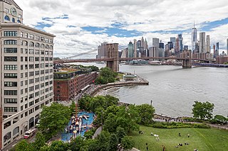
Brooklyn Bridge Park is an 85-acre (34 ha) park on the Brooklyn side of the East River in New York City. Designed by landscape architecture firm Michael Van Valkenburgh Associates, the park is located on a 1.3-mile (2.1 km) plot of land from Atlantic Avenue in the south, under the Brooklyn Heights Promenade and past the Brooklyn Bridge, to Jay Street north of the Manhattan Bridge. From north to south, the park includes the preexisting Empire–Fulton Ferry and Main Street Parks; the historic Fulton Ferry Landing; and Piers 1–6, which contain various playgrounds and residential developments. The park also includes Empire Stores and the Tobacco Warehouse, two 19th-century structures, and is a part of the Brooklyn Waterfront Greenway, a series of parks and bike paths around Brooklyn.
60. The Jewish Museum
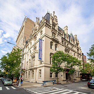
The Jewish Museum is an art museum and repository of cultural artifacts, housed at 1109 Fifth Avenue, in the former Felix M. Warburg House, along the Museum Mile on the Upper East Side of Manhattan, New York City. The first Jewish museum in the United States, as well as the oldest existing Jewish museum in the world, it contains the largest collection of art and Jewish culture excluding Israeli museums, more than 30,000 objects. While its collection was established in 1904 at the Jewish Theological Seminary of America, the museum did not open to the public until 1947 when Felix Warburg's widow sold the property to the Seminary. It focuses both on artifacts of Jewish history and on modern and contemporary art. The museum's collection exhibition, Scenes from the Collection, is supplemented by multiple temporary exhibitions each year.
Wikipedia: Jewish Museum (Manhattan) (EN), Website, Heritage Website
61. High Bridge
The High Bridge is a steel arch bridge connecting the New York City boroughs of the Bronx and Manhattan. Rising 140 ft (43 m) over the Harlem River, it is the city's oldest bridge, having opened as part of the Croton Aqueduct in 1848. The eastern end is located in the Highbridge section of the Bronx near the western end of West 170th Street, and the western end is located in Highbridge Park in Manhattan, roughly parallel to the end of West 174th Street.
62. Snug Harbor Cultural Center and Botanical Garden
Sailors' Snug Harbor, also known as Sailors Snug Harbor and informally as Snug Harbor, is a collection of architecturally significant 19th-century buildings on Staten Island, New York City. The buildings are set in an 83-acre (34 ha) park along the Kill Van Kull in New Brighton, on the North Shore of Staten Island. Some of the buildings and the grounds are used by arts organizations under the umbrella of the Snug Harbor Cultural Center and Botanical Garden.
63. American Folk Art Museum
The American Folk Art Museum is an art museum in the Upper West Side of Manhattan in New York City, at 2 Lincoln Square, Columbus Avenue at 66th Street. It is the premier institution devoted to the aesthetic appreciation of folk art and creative expressions of contemporary self-taught artists from the United States and abroad.
64. Broadway Theatre
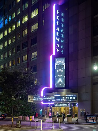
The Broadway Theatre is a Broadway theater at 1681 Broadway in the Theater District of Midtown Manhattan in New York City. Opened in 1924, the theater was designed by Eugene De Rosa for Benjamin S. Moss, who originally operated the venue as a movie theater. It has approximately 1,763 seats across two levels and is operated by The Shubert Organization. The Broadway Theatre is one of the few Broadway theaters that is physically on Broadway.
65. MoMA PS1
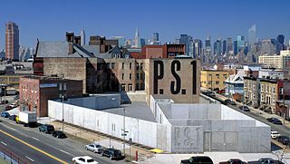
MoMA PS1 is a contemporary art institution at 22-01 Jackson Avenue in the Long Island City neighborhood of Queens in New York City, United States. In addition to its exhibitions, the institution organizes the Sunday Sessions performance series, the Warm Up summer music series, and the Young Architects Program with the Museum of Modern Art. MoMA PS1 has been affiliated with the Museum of Modern Art since January 2000 and, as of 2013, attracts about 200,000 visitors a year.
66. Gagosian
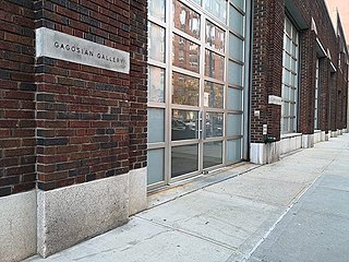
The Gagosian Gallery is a modern and contemporary art gallery owned and directed by Larry Gagosian. The gallery exhibits some of the most well-known artists of the 20th and 21st centuries. As of 2024, Gagosian employs 300 people at 19 exhibition spaces – including New York City, London, Paris, Basel, Beverly Hills, San Francisco, Rome, Athens, Geneva, and Hong Kong – designed by architects such as Caruso St John, Richard Gluckman, Richard Meier, Jean Nouvel, and Annabelle Selldorf.
67. James Earl Jones Theatre
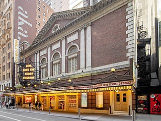
The James Earl Jones Theatre, originally the Cort Theatre, is a Broadway theater at 138 West 48th Street, between Seventh Avenue and Sixth Avenue, in the Theater District of Midtown Manhattan in New York City, United States. It was built in 1912 and designed by architect Thomas W. Lamb for impresario John Cort. An annex to the west of the theater, built between 2021 and 2022, was designed by Kostow Greenwood Architects. The Jones has 1,092 seats across three levels and is operated by the Shubert Organization. Both the facade and interior of the theater are New York City designated landmarks.
68. Inwood Hill Park
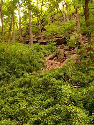
Inwood Hill Park is a 196 acres (79 ha) public park in the Inwood neighborhood of Manhattan, New York City, operated by the New York City Department of Parks and Recreation. On a high schist ridge that rises 200 feet (61 m) above the Hudson River from Dyckman Street to the northern tip of the island, Inwood Hill Park's densely folded, glacially scoured topography contains the largest remaining old-growth forest on the island of Manhattan. The area is also known as the Shorakapkok Preserve, shorakapkok meaning 'the sitting place' in the Munsee language used by the Wecquaesgeek tribe who inhabited the area for nearly 700 years. Unlike other Manhattan parks, Inwood Hill Park is largely natural and consists of mostly wooded, non-landscaped hills.
69. Asia Society
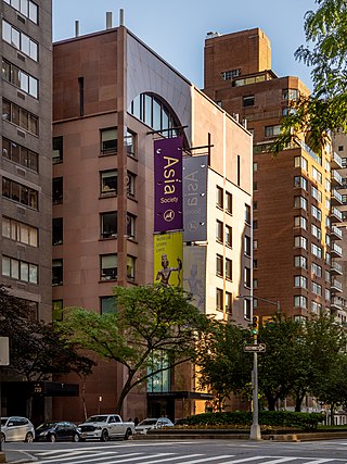
The Asia Society is a 501(c)(3) organization that focuses on educating the world about Asia. It has several centers in the United States and around the world. These centers are overseen by the Society's headquarters in New York City, which includes a museum that exhibits art from countries in Asia and Oceania. Asia Society also publishes an online magazine, ChinaFile.
70. Tompkins Square Park
Tompkins Square Park is a 10.5-acre (4.2 ha) public park in the Alphabet City portion of East Village, Manhattan, New York City. The square-shaped park, bounded on the north by East 10th Street, on the east by Avenue B, on the south by East 7th Street, and on the west by Avenue A, is abutted by St. Marks Place to the west. The park opened in 1834 and is named for Daniel D. Tompkins, Vice President of the United States.
71. Museum at Eldridge Street
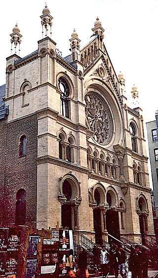
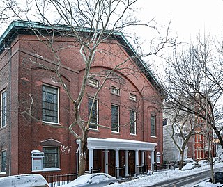
The Eldridge Street Synagogue is an Orthodox Jewish synagogue at 12–16 Eldridge Street in the Chinatown and Lower East Side neighborhoods of Manhattan in New York City. Built in 1887 for Congregation Kahal Adath Jeshurun, the synagogue is one of the first erected in the U.S. by Eastern European Jews. The congregation, officially known as Kahal Adath Jeshurun with Anshe Lubz, still owns the synagogue and hosts weekly services there in the 21st century. The Museum at Eldridge Street, founded in 1986 as the Eldridge Street Project, also occupies the synagogue under a long-term lease. The building is a National Historic Landmark and a New York City designated landmark.
Wikipedia: Eldridge Street Synagogue (EN), Website, Opening Hours
72. Lyceum Theatre
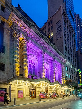
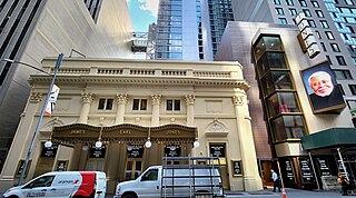
The Lyceum Theatre is a Broadway theater at 149 West 45th Street, between Seventh Avenue and Sixth Avenue, in the Theater District of Midtown Manhattan in New York City. Opened in 1903, the Lyceum Theatre is one of the oldest surviving Broadway venues, as well as the oldest continuously operating legitimate theater in New York City. The theater was designed by Herts & Tallant in the Beaux-Arts style and was built for impresario Daniel Frohman. It has 922 seats across three levels and is operated by The Shubert Organization. The facade became a New York City designated landmark in 1974, and the lobby and auditorium interiors were similarly designated in 1987.
73. Hudson River Park
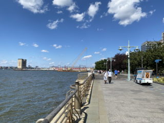
Hudson River Park is a waterfront park on the North River that extends from 59th Street south to Battery Park in the New York City borough of Manhattan. The park, a component of the Manhattan Waterfront Greenway, stretches 4.5 miles (7.2 km) and comprises 550 acres (220 ha), making it the second-largest park in Manhattan after the 843-acre (341 ha) Central Park.
74. Samuel J. Friedman Theatre
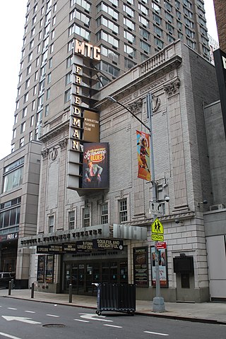
The Samuel J. Friedman Theatre, formerly the Biltmore Theatre, is a Broadway theater at 261 West 47th Street in the Theater District of Midtown Manhattan in New York City. Opened in 1925, it was designed by Herbert J. Krapp in the neo-Renaissance style and was constructed for Irwin Chanin. It has 650 seats across two levels and is operated by the Manhattan Theatre Club (MTC). The auditorium interior is a New York City landmark, and the theater is listed on the National Register of Historic Places. Since 2008, the theater has been named for Broadway publicist Samuel J. Friedman (1912–1974), whose family was a major donor to MTC.
75. Saint Patrick's Old Cathedral
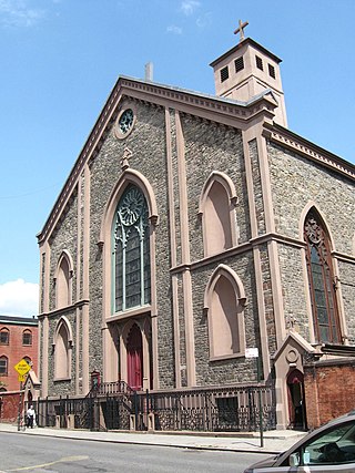
The Basilica of Saint Patrick's Old Cathedral, sometimes shortened to St. Patrick's Old Cathedral or simply Old St. Patrick's, is a Catholic parish church, a basilica, and the former cathedral of the Archdiocese of New York, located in the Nolita neighborhood of Lower Manhattan, New York City. Built between 1809 and 1815 and designed by Joseph-François Mangin in the Gothic Revival style, it was the seat of the archdiocese until the current St. Patrick's Cathedral in Midtown Manhattan opened in 1879. Currently, liturgies are celebrated in English, Italian, Spanish, and Chinese. The church is at 260–264 Mulberry Street between Prince and Houston streets, with the primary entrance on Mott Street. Old St. Patrick parish merged with Most Precious Blood parish, and the two churches share priests and administrative staff.
76. Central Synagogue
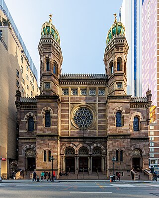
Central Synagogue is a Reform Jewish congregation and synagogue at 652 Lexington Avenue, at the corner with 55th Street, in the Midtown Manhattan neighborhood of New York City. The current congregation was formed in 1898 through the merger of two 19th-century synagogues: Shaar Hashomayim and Ahawath Chesed. The synagogue building was constructed from 1870 to 1872 for Ahawath Chesed. As of 2014, Angela Buchdahl is Central's senior rabbi.
77. Broadhurst Theatre
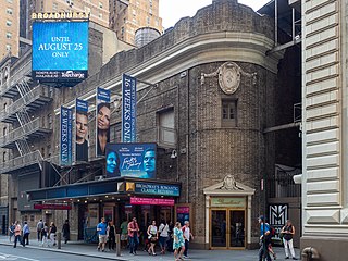
The Broadhurst Theatre is a Broadway theater at 235 West 44th Street in the Theater District of Midtown Manhattan in New York City. Opened in 1917, the theater was designed by Herbert J. Krapp and was built for the Shubert brothers. The Broadhurst Theatre is named for British-American theatrical producer George Broadhurst, who leased the theater before its opening. It has 1,218 seats across two levels and is operated by The Shubert Organization. Both the facade and the auditorium interior are New York City landmarks.
78. Hudson Theatre
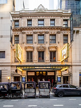
The Hudson Theatre is a Broadway theater at 139–141 West 44th Street, between Seventh Avenue and Sixth Avenue, in the Theater District of Midtown Manhattan in New York City. One of the oldest surviving Broadway venues, the Hudson was built from 1902 to 1903. The exterior was designed by J. B. McElfatrick & Son, while Israels & Harder oversaw the completion of the interior. The theater has 970 seats across three levels. Both its exterior and interior are New York City designated landmarks, and the theater is on the National Register of Historic Places.
79. Circle in the Square Theatre
The Circle in the Square Theatre is a Broadway theater at 235 West 50th Street, within the basement of Paramount Plaza, in the Midtown Manhattan neighborhood of New York City. The current Broadway theater, completed in 1972, is the successor of an off-Broadway theater of the same name, co-founded around 1950 by a group that included Theodore Mann and José Quintero. The Broadway venue was designed by Allen Sayles; it originally contained 650 seats and uses a thrust stage that extends into the audience on three sides. The theater had 776 seats as of 2024.
80. Booth Theatre
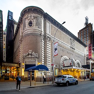
The Booth Theatre is a Broadway theater at 222 West 45th Street in the Theater District of Midtown Manhattan in New York City. Opened in 1913, the theater was designed by Henry Beaumont Herts in the Italian Renaissance style and was built for the Shubert brothers. The venue was originally operated by Winthrop Ames, who named it for 19th-century American actor Edwin Booth. It has 800 seats across two levels and is operated by The Shubert Organization. The facade and parts of the interior are New York City landmarks.
81. Helen Hayes Theatre
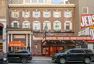
The Hayes Theater is a Broadway theater at 240 West 44th Street in the Theater District of Midtown Manhattan in New York City. Named for actress Helen Hayes, the venue is operated by Second Stage Theater. It is the smallest Broadway theater, with 597 seats across two levels. The theater was constructed in 1912 for impresario Winthrop Ames and designed by Ingalls & Hoffman in a neo-Georgian style. The original single-level, 299-seat configuration was modified in 1920, when Herbert J. Krapp added a balcony to expand the Little Theatre. The theater has served as a legitimate playhouse, a conference hall, and a broadcasting studio throughout its history.
82. Winter Garden Theatre
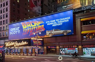
The Winter Garden Theatre is a Broadway theatre at 1634 Broadway in the Midtown Manhattan neighborhood of New York City. Originally designed by architect William Albert Swasey, it opened in 1911. The Winter Garden's current design dates to 1922, when it was completely remodeled by Herbert J. Krapp. Due to the size of its auditorium, stage, and backstage facilities, it is favored for large musical productions. It has 1,600 seats and is operated by The Shubert Organization. The auditorium interior is a New York City landmark.
83. Lincoln Center Theater
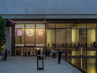
The Vivian Beaumont Theater is a Broadway theater in the Lincoln Center complex at 150 West 65th Street on the Upper West Side of Manhattan in New York City. Operated by the nonprofit Lincoln Center Theater (LCT), the Beaumont is the only Broadway theater outside the Theater District near Times Square. Named after heiress and actress Vivian Beaumont Allen, the theater was one of the last structures designed by modernist architect Eero Saarinen. The theater shares a building with the New York Public Library for the Performing Arts and contains two off-Broadway venues, the Mitzi E. Newhouse Theater and the Claire Tow Theater.
84. Gracie Mansion
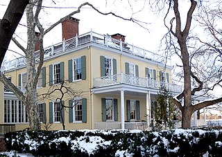
Gracie Mansion is the official residence of the mayor of New York City. Built in 1799, it is located in Carl Schurz Park, at East End Avenue and 88th Street in the Yorkville neighborhood of Manhattan. The federal-style mansion overlooks Hell Gate in the East River and consists of the original two-story house and an annex built in 1966. The original house is a New York City designated landmark and is listed on the National Register of Historic Places.
85. Belasco Theatre
The Belasco Theatre is a Broadway theater at 111 West 44th Street, between Seventh Avenue and Sixth Avenue, in the Theater District of Midtown Manhattan in New York City. Originally known as the Stuyvesant Theatre, it was built in 1907 and designed by architect George Keister for impresario David Belasco. The Belasco Theatre has 1,016 seats across three levels and has been operated by The Shubert Organization since 1948. Both the facade and interior of the theater are New York City landmarks.
86. Plymouth Church
Plymouth Church is an historic church located at 57 Orange Street between Henry and Hicks Streets in the Brooklyn Heights neighborhood of Brooklyn, New York City; the Church House has the address 75 Hicks Street. The church was built in 1849–50 and was designed by Joseph C. Wells. Under the leadership of its first minister, Henry Ward Beecher, it became the foremost center of anti-slavery sentiment in the mid-19th century. It has been listed on the National Register of Historic Places since 1961, and has been a National Historic Landmark since 1966. It is part of the Brooklyn Heights Historic District, created by the New York City Landmarks Preservation Commission in 1965.
87. Bethesda Fountain
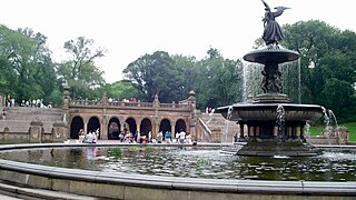
Bethesda Terrace and Fountain are two architectural features overlooking the southern shore of the Lake in New York City's Central Park. The fountain, with its Angel of the Waters statue, is located in the center of the terrace.
Wikipedia: Bethesda Terrace and Fountain (EN), Website, Website Alternate
88. Public Theater
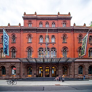
The Public Theater is an arts organization in New York City. Founded by Joseph Papp, The Public Theater was originally the Shakespeare Workshop in 1954; its mission was to support emerging playwrights and performers. Its first production was the musical Hair in 1967. Since Papp, the theatre has been led by JoAnne Akalaitis (1991–1993), and George C. Wolfe (1993–2004), and is currently under Artistic Director Oskar Eustis and Executive Director Patrick Willingham.
89. Lena Horne Theatre
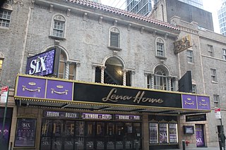
The Lena Horne Theatre is a Broadway theater at 256 West 47th Street in the Theater District of Midtown Manhattan in New York City. Opened in 1926, it was designed by Herbert J. Krapp in a Spanish Revival style and was constructed for Irwin Chanin. It has 1,069 seats across two levels and is operated by the Nederlander Organization. Both the facade and the auditorium interior are New York City landmarks.
90. Majestic Theatre
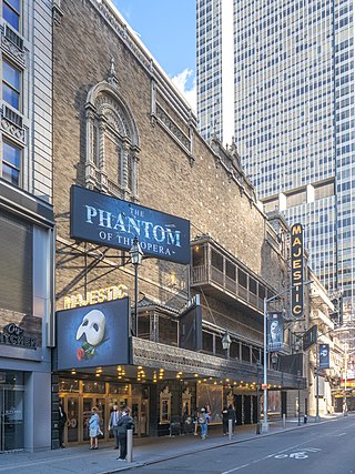
The Majestic Theatre is a Broadway theater at 245 West 44th Street in the Theater District of Midtown Manhattan in New York City. Opened in 1927, the theater was designed by Herbert J. Krapp in a Spanish style and was built for real-estate developer Irwin S. Chanin. It has 1,681 seats across two levels and is operated by The Shubert Organization. Both the facade and interior are New York City landmarks.
91. Neil Simon Theater
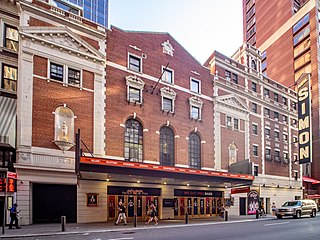
The Neil Simon Theatre, originally the Alvin Theatre, is a Broadway theater at 250 West 52nd Street in the Theater District of Midtown Manhattan in New York City. Opened in 1927, the theater was designed by Herbert J. Krapp and was built for Alex A. Aarons and Vinton Freedley. The original name was an amalgamation of Aarons's and Freedley's first names; the theater was renamed for playwright Neil Simon in 1983. The Neil Simon has 1,467 seats across two levels and is operated by the Nederlander Organization. Both the facade and the auditorium interior are New York City landmarks.
92. Lunt-Fontanne Theatre
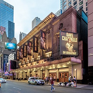
The Lunt-Fontanne Theatre, originally the Globe Theatre, is a Broadway theater at 205 West 46th Street in the Theater District of Midtown Manhattan in New York City. Opened in 1910, the Lunt-Fontanne Theatre was designed by Carrère and Hastings in the Beaux-Arts style for Charles Dillingham. The theater is named after theatrical couple Alfred Lunt and Lynn Fontanne; its original name was inspired by that of the Globe Theatre, London's Shakespearean playhouse. The current configuration of the interior, dating to 1958, has about 1,505 seats across two levels and is operated by the Nederlander Organization. The facade is a New York City designated landmark.
93. New York City Center
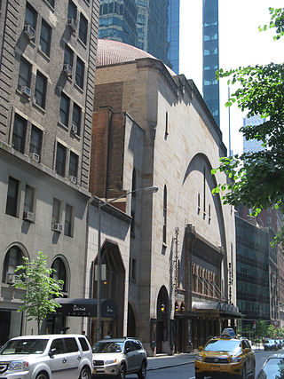
New York City Center is a performing arts center at 131 West 55th Street between Sixth and Seventh Avenues in the Midtown Manhattan neighborhood of New York City. Developed by the Shriners between 1922 and 1924 as a Masonic meeting house, it has operated as a performing arts complex owned by the government of New York City. City Center is a performing home for several major dance companies as well as the Manhattan Theatre Club (MTC), and it hosts the Encores! musical theater series and the Fall for Dance Festival annually.
94. Barrymore Theatre
The Ethel Barrymore Theatre is a Broadway theater at 243 West 47th Street in the Theater District of Midtown Manhattan in New York City. Opened in 1928, it was designed by Herbert J. Krapp in the Elizabethan, Mediterranean, and Adam styles for the Shubert family. The theater, named in honor of actress Ethel Barrymore, has 1,058 seats and is operated by the Shubert Organization. Both the facade and the auditorium interior are New York City landmarks.
95. Saint Paul's Chapel
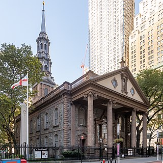
St. Paul's Chapel is a chapel building of Trinity Church, an episcopal parish, located at 209 Broadway, between Fulton Street and Vesey Street, in Lower Manhattan, New York City. Built in 1766, it is the oldest surviving church building in Manhattan and one of the nation's most well renowned examples of Late Georgian church architecture.
Wikipedia: St. Paul's Chapel (EN), Website, Heritage Website
96. Prospect Park Zoo
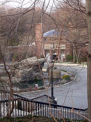
The Prospect Park Zoo is a 12-acre (4.9 ha) zoo located off Flatbush Avenue on the eastern side of Prospect Park, Brooklyn, New York City. As of 2016, the zoo houses 864 animals representing about 176 species, and as of 2007, it averaged 300,000 visitors annually. The Prospect Park Zoo is operated by the Wildlife Conservation Society (WCS). In conjunction with the Prospect Park Zoo's operations, the WCS offers children's educational programs, is engaged in restoration of endangered species populations, runs a wildlife theater, and reaches out to the local community through volunteer programs.
97. Nederlander Theatre
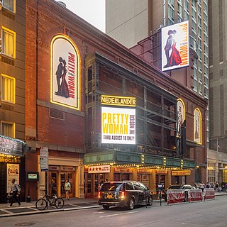
The Nederlander Theatre is a Broadway theater at 208 West 41st Street in the Theater District of Midtown Manhattan in New York City. Opened in 1921, it was designed by William Neil Smith for theatrical operator Walter C. Jordan. It has around 1,235 seats across two levels and is operated by the Nederlander Organization. Since 1980, it has been named for American theater impresario David Tobias Nederlander, father of theatrical producer James M. Nederlander. It is the southernmost Broadway theater in the Theater District.
98. Helmsley Building
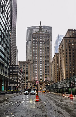
The Helmsley Building is a 35-story skyscraper at 230 Park Avenue between East 45th and 46th Streets, just north of Grand Central Terminal, in the Midtown Manhattan neighborhood of New York City. It was built in 1929 as the New York Central Building and was designed by Warren & Wetmore in the Beaux-Arts style. The building has been described as the last major project built as part of the Terminal City complex around Grand Central.
Wikipedia: Helmsley Building (EN), Website, Heritage Website
99. Grace Church
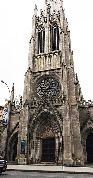
Grace Church is a historic parish church in Manhattan, New York City which is part of the Episcopal Diocese of New York. The church is located at 800–804 Broadway, at the corner of East 10th Street, where Broadway bends to the south-southeast, bringing it in alignment with the avenues in Manhattan's grid. Grace Church School and the church houses—which are now used by the school—are located to the east at 86–98 Fourth Avenue between East 10th and 12th Streets. In 2021, it reported 1,038 members, average attendance of 212, and $1,034,712 in plate and pledge income.
Wikipedia: Grace Church (Manhattan) (EN), Website, Heritage Website
100. Temple of Dendur
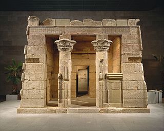
The Temple of Dendur is a Roman Egyptian religious structure originally located in Tuzis, Nubia about 80 kilometres (50 mi) south of modern Aswan. Around 23 BCE, Emperor Augustus commissioned the temple dedicated to the Egyptian goddess Isis and deified brothers Pedesi and Pihor from Nubia.
Share
How likely are you to recommend us?
Disclaimer Please be aware of your surroundings and do not enter private property. We are not liable for any damages that occur during the tours.

